Local residents and visitors are asked to remain aware that weather conditions may make some streets on the Hattiesburg campus and coastal sites impassable or hazardous to navigate.
Motorists at the Gulf Coast Research Laboratory in Ocean Springs should be aware of the potential for flooding on Halstead Road near the site’s entrance.
Motorists should use caution in these areas during times of heavy rain and should not enter flooded areas.
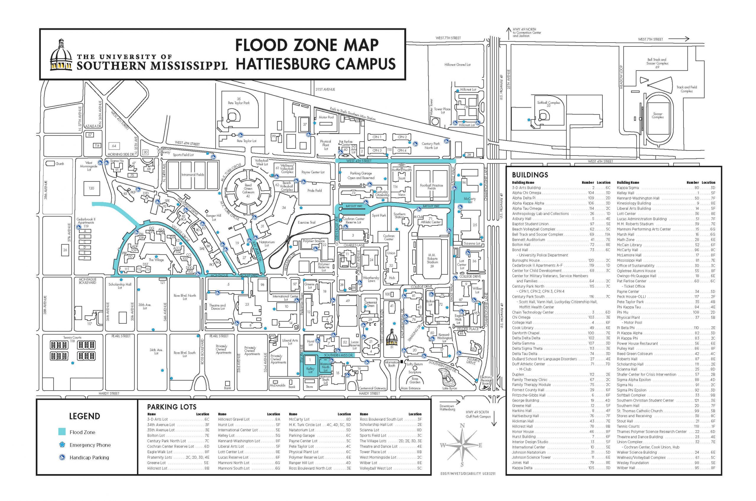
Hattiesburg Campus
Motorists on the Hattiesburg campus should be aware of potential flood damage to parked vehicles in these areas:
- Pine Haven Drive around Sorority Village
- Montague Boulevard between Kay James Drive and Ross Boulevard
- 10 parking spaces on the south end of Fraternity Drive (west side of the street) at Montague Boulevard
- West 4th Street between Golden Eagle Avenue and Eagle Walk
- Southern Miss Drive between 30th and 31st Avenues
- Ray Guy Way at Century Park South/Spirit Park
- South end of Kay James Drive at Montague Boulevard (next to the DuBard School)
- Trent Lott Center west lot, next to M.M. Roberts Stadium
- Ray Guy Way at Eagle Walk, by the raised crosswalk
- Parking area at the southwest corner of McCarty Hall
(Click image to enlarge)
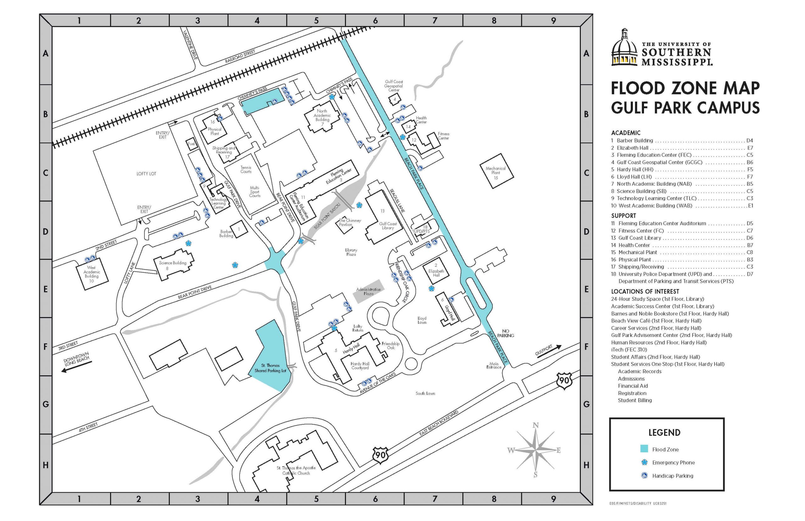
Gulf Park Campus
Motorists on the Gulf Park campus in Long Beach should be aware of potential flood damage to parked vehicles at the shared parking lot with St. Thomas the Apostle Catholic Church on the west side of campus, along Beach Park Place, as well as the four-way stop at Bear Point and Gulf Park drives.
(Click image to enlarge)
Gulf Coast Research Laboratory
Motorists at the Gulf Coast Research Laboratory in Ocean Springs should also be aware of the potential for flooding on Halstead Road near the site’s entrance.
Motorists should use caution in these areas during times of heavy rain and should not enter flooded areas.